MREI

Mangrove Restoration Effectiveness Index research focused on restoration assessment and remote sensing evaluation.

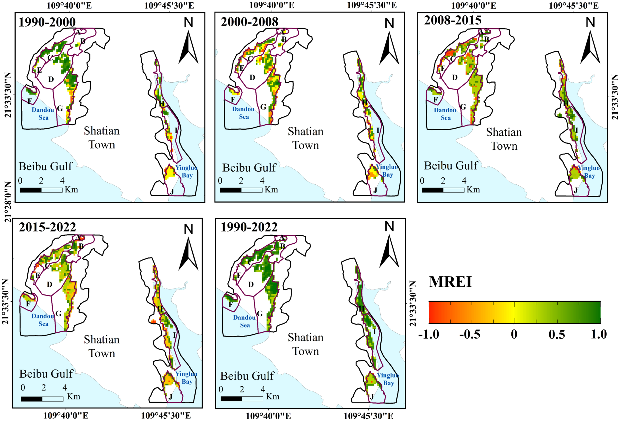
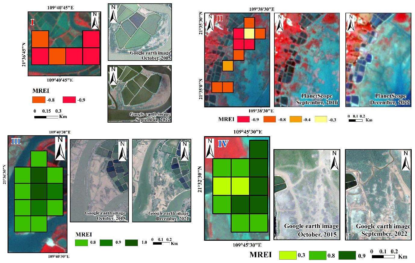
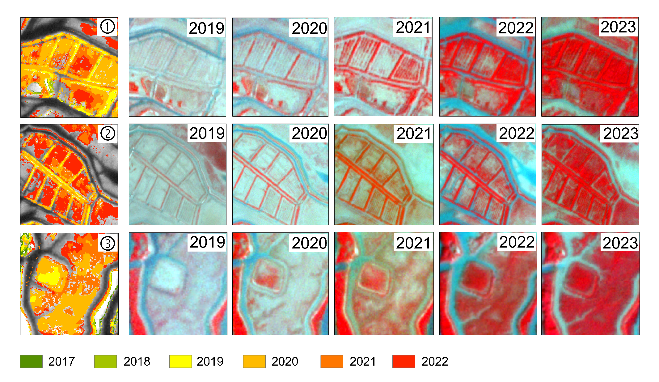
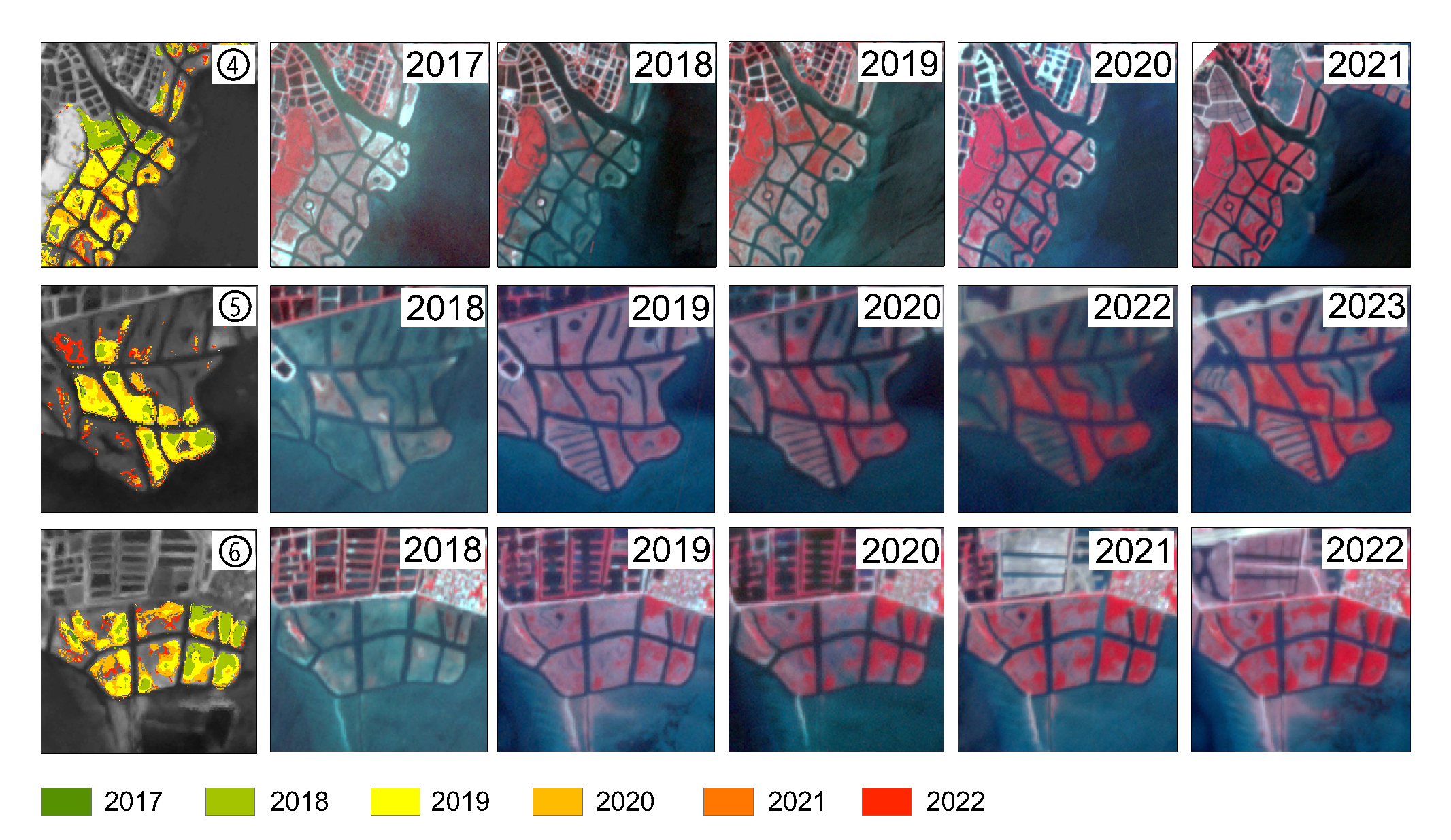
Mangroves have been severely threatened by intensive human activities, so many countries and regions have carried out mangrove restoration projects. The evaluation of mangrove restoration effectiveness is of great significance for scientific decision-making for restoration engineering and wetland management. In this study, we proposed a remote-sensing-based Mangrove Restoration Effectiveness Index (MREI) to quantitatively evaluate mangrove restoration effectiveness using Landsat time-series imagery. The Guangxi Shankou Mangrove National Natural Reserve, a UNESCO Biosphere Reserve, was selected as the study area, where multiple phases of mangrove afforestation were implemented from 1990 to 2022. The MREI was developed by integrating changes in mangrove area and the Normalized Difference Vegetation Index (NDVI) during different restoration phases. Furthermore, the Persistence of Restoration Effectiveness (PRE) was introduced to characterize the temporal trajectory and long-term stability of restoration effectiveness, while the Process-based Restoration Effectiveness Index (PREI) was developed to assess restoration effectiveness at the village scale. The proposed framework effectively captured the spatiotemporal dynamics of mangrove restoration and provides a practical and transferable approach for evaluating restoration effectiveness in coastal wetland ecosystems.

TRPMM

Time-series remote sensing analysis of mangrove plantation monitoring with dynamic visual examples from two study areas.

Artificial afforestation has become one of the primary drivers of rapid mangrove expansion in recent years. Accurate and timely monitoring of mangrove planting areas is therefore essential for evaluating restoration effectiveness and supporting wetland management. In this study, a "detect-monitor-validate" framework was proposed for dynamic monitoring of mangrove planting areas. The "detect" component integrated PlanetScope and Sentinel-2 imagery to identify the potential distribution of mangroves. The "monitor" component introduced a Threshold- and Rule-based Planted Mangrove Monitoring (TRPMM) method based on time-series PlanetScope imagery to track annual mangrove expansion. The threshold strategy was developed using time-series NDVI and NDWI, while the rule-based framework incorporated land-cover transition rules, intra-annual consistency rules, and inter-annual consistency rules to improve monitoring reliability. The "validate" component utilized high-spatial-resolution PlanetScope imagery and Google Earth data for validation and accuracy assessment. The proposed framework effectively captured the spatiotemporal dynamics of mangrove expansion and demonstrated strong capability for monitoring planted mangroves in restoration regions. The results further indicated that thresholds, optical imagery quality, and temporal consistency rules played important roles in influencing monitoring performance. Compared with conventional NDVI-based approaches, the TRPMM framework substantially improved the identification of mangrove planting expansion. This method has strong potential for large-scale and long-term monitoring of mangrove restoration under the context of global coastal ecosystem restoration initiatives.

Driving Mechanisms of Wetland Dynamics

Wetland dynamics and driving mechanisms research from a spatiotemporal and asynchronous perspective.

The mechanisms driving wetland distribution (WD) have been widely investigated; however, the driving mechanisms underlying wetland change (WC) remain insufficiently understood, particularly from an asynchronous-spatiotemporal perspective. In this study, an integrated framework combining remote sensing technologies and partial least squares structural equation modeling (PLS-SEM) was developed to explore the impacts of human activity (HA) and natural environmental factors on WC. Within the proposed framework, HA was characterized using socioeconomic indicators, including economic and population data. Natural environmental conditions were represented by the fundamental natural environment (FNE), primarily associated with terrain characteristics, and the non-stable natural environment (NNE), mainly related to hydrological and temperature conditions. Furthermore, changes in these driving factors, including human activity change (HAC), fundamental natural environment change (FNEC), and non-stable natural environment change (NNEC), were incorporated to analyze their dynamic influences on WC. The proposed model effectively revealed the asynchronous and spatially heterogeneous relationships between wetland dynamics and multiple driving factors in the Pearl River Delta from 1980 to 2020. The results indicated substantial differences between the mechanisms controlling WD and WC, as well as temporal variations in the impacts of human activities and environmental changes on wetland dynamics. By coupling wetland decrease with HAC, regions requiring different wetland management and restoration strategies were further identified. Overall, the proposed framework provides an effective approach for understanding wetland change mechanisms and offers valuable support for wetland restoration and sustainable management in regions experiencing severe wetland degradation.