Driving Mechanisms of Wetland Dynamics
Highlights
- A dynamic driving mechanism model of wetland change was developed.
- The asynchrony-spatiotemporal mechanisms were quantified based on the model.
- The fundamental natural environment determines wetland distribution and limits human activities, protecting wetlands from damage.
- The distribution of the impact of human activities on wetland loss was mapped.
Methods
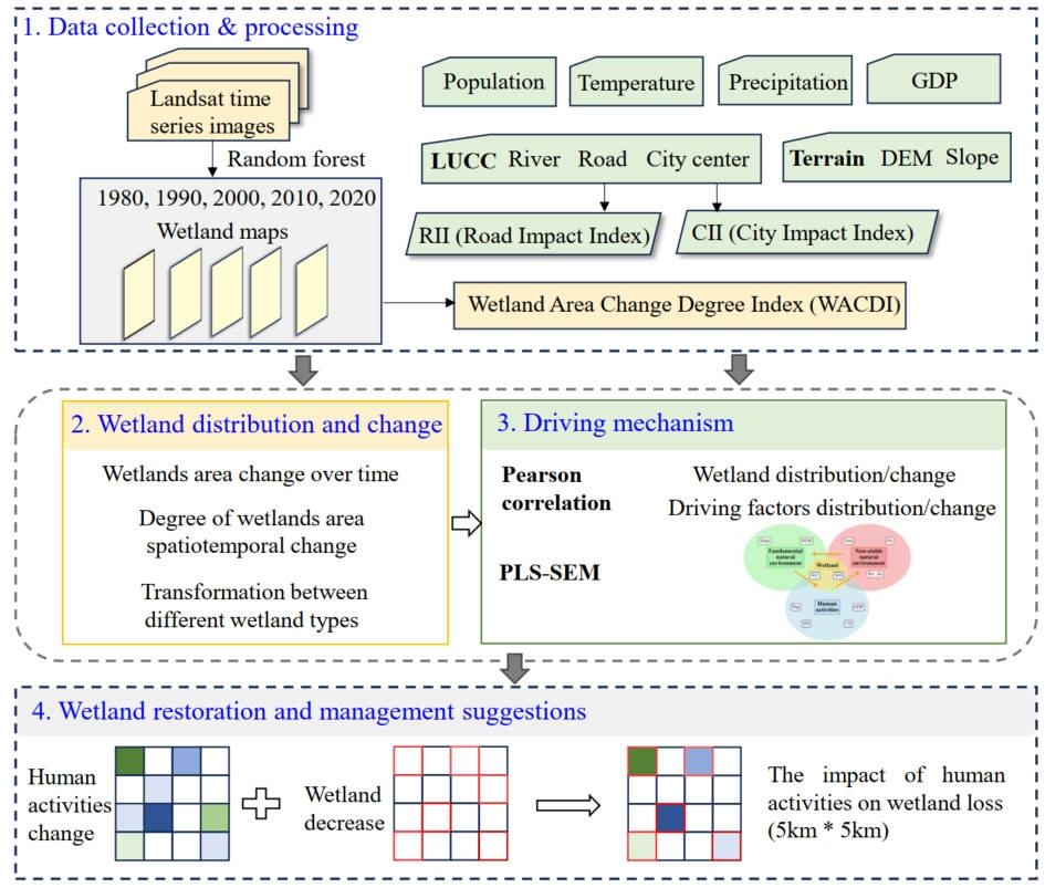
In this study, we investigated the spatiotemporal dynamics of wetlands in the Pearl River Delta (PRD) from 1980 to 2020 and analyzed the impacts of natural factors and human activities (HA) on wetland degradation (WD) and wetland change (WC). An asynchronous spatiotemporal perspective was adopted to reveal the driving mechanisms underlying wetland changes.
First, seven wetland categories were defined, and wetland distribution maps were generated using the Random Forest algorithm based on Landsat imagery. Next, indicators representing natural factors and human activities influencing wetland distribution were constructed at a 5 km x 5 km grid scale through spatial statistical analysis. Correlation analysis and Partial Least Squares Structural Equation Modeling (PLS-SEM) were then applied to quantify and interpret the driving mechanisms of wetland distribution and change, while the robustness of the results was further evaluated.
Finally, the spatial coupling relationship between areas of intense human activity change (HAC) and wetland degradation was analyzed, and targeted recommendations for wetland restoration and sustainable management in the PRD were proposed.
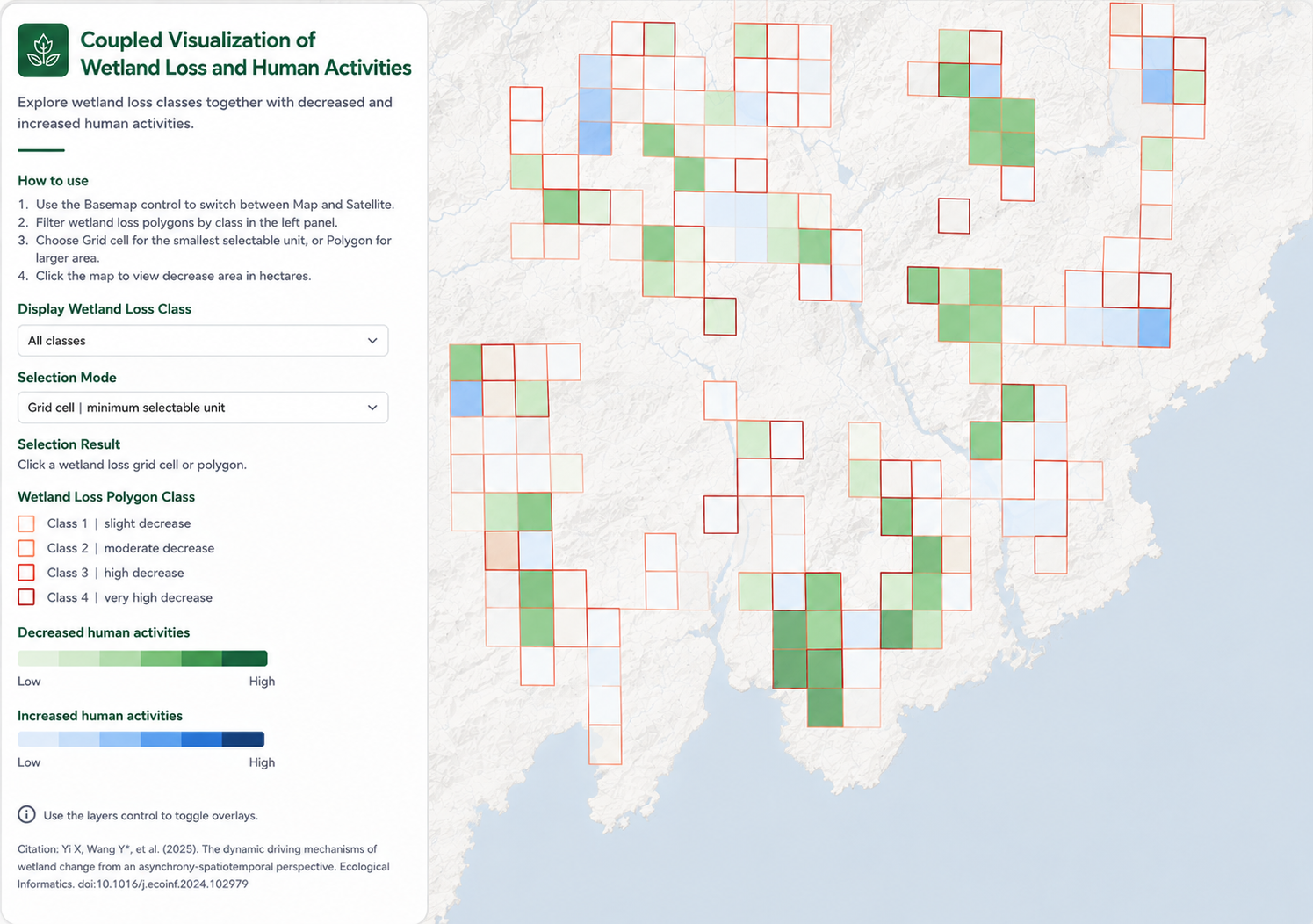
Google Earth Engine App
Coupled Visualization of Wetland Loss and Human Activities in the PRD at a 5 x 5 km Grid Scale (2010-2020)